National Highways urges road users to 'be prepared' as Lancashire braces for snow
and live on Freeview channel 276
A band of rain, sleet and snow will push north on Thursday (February 8) bringing up to 2cm snow at lower-levels.
2-5cm is predicted on ground above 200m, and perhaps as much as 10-20cm above 400m.
Advertisement
Hide AdAdvertisement
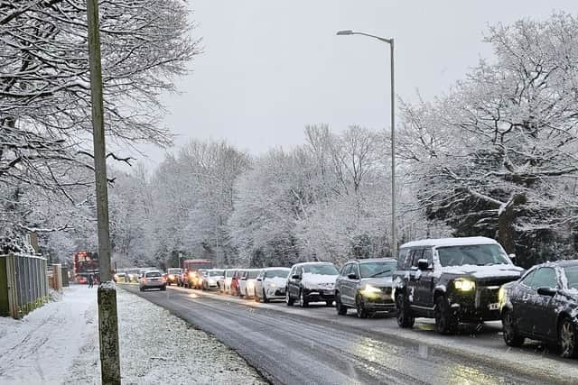
Hide AdA yellow weather warning covering all of Lancashire has subsequently been extended by the Met Office.
The warning will be in place from 6am on Thursday until 6am on Friday (February 9).

National Highways has also issued its own severe amber weather alert, which is based on different criteria and is focused on the potential impact to the strategic road network.
Amy Shaw, National Network Manager at National Highways, said: "Freezing conditions as we are expecting tonight bring hazards such as snow and ice, so take every possible step to understand your journey in advance and allow lots of extra time when travelling; prepare for the unexpected.
Advertisement
Hide AdAdvertisement
Hide Ad"When planning your journey, check the weather forecasts, and if weather conditions become challenging, adjust your driving behaviour and take extra care."
An amber weather warning for snow was been issued by the Met Office
The warning covers parts of West Yorkshire - touching on Rossendale, Pendle and Burnley.
It will be in place from 12pm on Thursday until 6pm the same day.
Advertisement
Hide AdAdvertisement
Hide AdMet Office Deputy Chief Meteorologist Chris Almond said: "There's an increased signal for wintry hazards as we move through the week as cold air from the north moves over the UK.
“It's from Thursday that the snow risk becomes potentially impactful, as mild air attempts to move back in from the south, bumping into the cold air and increasing the chance of snow where the two systems meet.
"While there are still lots of details to work out, the initial snow risk looks highest in northern England and Wales from Thursday."

HGV drivers are asked to consider avoiding parts of the road network with steeper than normal inclines, particularly in northern parts of the country.
Advertisement
Hide AdAdvertisement
Hide AdThe predicted weather conditions could lead to vehicles becoming jack-knifed or stranded which can prevent gritting vehicles treating the road with salt or ploughing snow clear.
With precipitation expected to turn lighter and patchier as it moves north, no more than 2-5 cm is expected on the A66 above 300m.
Patches of fog and high winds, gusting around 50 mph, could also make driving conditions treacherous on higher and more exposed routes.
National Highways, in conjunction with the Met Office, are strongly advising that travel in these areas is likely to be extended or even disrupted.
Advertisement
Hide AdAdvertisement
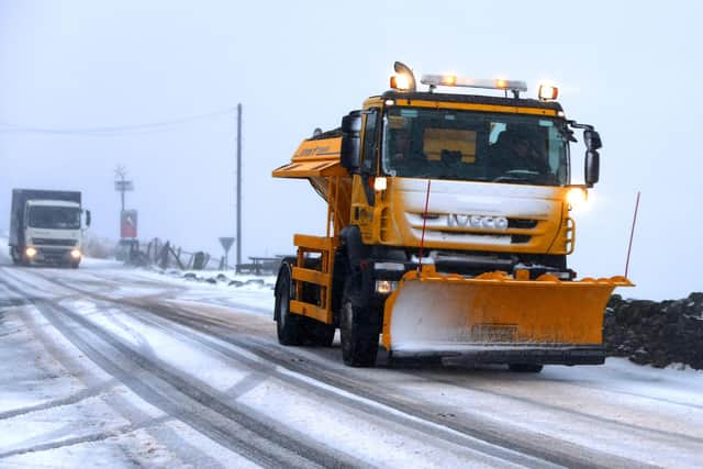
Hide AdA fleet of 530 gritters are on hand for National Highways to call upon during sub-zero temperatures.
Abigail Oakes, Senior Account Manager at the Met Office, said: "We're working closely with National Highways throughout the year to help people stay safe on the roads, and providing the best possible support for road users during periods of severe weather.
"All of the information we gather helps National Highways to inform road users about current road conditions whatever the weather.
"We also share information through channels including our website, third party travel providers – including sat nav companies – and local radio stations."
Advertisement
Hide AdAdvertisement
Hide AdNational Highways also reminded motorists to keep TRIP in mind ahead of journeys – Top-up: oil, water, screenwash; Rest: rest every two hours; Inspect: Inspect tyres and lights and Prepare: check your route and the weather forecast.
Comment Guidelines
National World encourages reader discussion on our stories. User feedback, insights and back-and-forth exchanges add a rich layer of context to reporting. Please review our Community Guidelines before commenting.